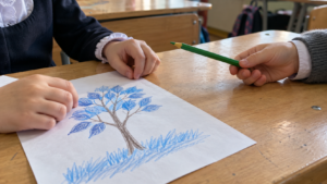


On the kitchen table lie two maps of Africa, and both are white.
One from a school atlas that my mother brought with her in a box of photographs and still hasn't thrown away. Thin blue lines, yellowish paper, the year and last name written in pencil in the corner. The second was printed on the printer half an hour ago for her eleven-year-old son.
The mother looks at hers and sees autumn, colored pencils, and a teacher who used to dock points for signing across the border. The son looks at his and sees a blank sheet with lines. He honestly asks what to do here when everything is already drawn.
The question, by the way, is reasonable. And the answer to it explains why this strange format even exists.
A format that does not exist in American schools
An outline map is a map without labels. It has land outlines and borders, sometimes rivers and parallels, and nothing else. No names, no cities, no elevations. A student fills all of this in on it.
In a Russian school, such a sheet is familiar to everyone; it comes with the atlas and is filled out throughout the entire academic year. It is entirely absent from American school supplies. There, they work with pre-made maps, interactive services, and occasionally coloring pages, but there is no systematic practice of filling out a blank sheet.
Hence the misunderstanding in the kitchen. For the mother, it is an obvious school tool, like a squared notebook. For the son, it is a mysterious paper received from his parents instead of a normal assignment.
Why a white sheet works better than a colored one
There is only one argument in favor of the outline map, but it's a strong one. The child plots the object by hand, and the hand remembers more reliably than the eye.
The mechanics here are not mystical. To label a river, you first have to find it on a real map, then locate the corresponding line on your blank sheet of paper, then decide where the name will fit, and only then write it. Four operations instead of a single sweeping glance. Each requires attention, and attention leaves a trace.
A ready-made map gives a child everything at once and therefore leaves no trace. They look at a labeled Africa for forty seconds, close the atlas, and remember pretty much nothing a day later. A coastline traced by their own hand is recognized later in any form, whether on a globe, in a logo, or in the corner of a television screen saver.
The same principle works in all learning. Handwritten notes last longer than a photographed page, and for the same reason.
What the child sees instead of the assignment
Let's go back to the blank sheet of paper and my son's question about what to do here if everything has already been drawn.
Behind this question lies a true misunderstanding, and it is precisely that which needs to be explained. The child does not see the difference between a map and an outline map because, to them, any map is just a picture to look at. The thought that a map can be made by oneself never even crossed their mind.
One phrase helps. This is not a map, this is a map blank, and it will become a map when you fill it out.
After that, a second question usually arises: why fill out what is already on the internet? And the honest answer here is this. For the same reason that people solve math problems when they have a calculator. The value is not in the result; it is in what happens in your head on the way to it.
Which one to choose from a dozen similar ones
The mother spent an hour searching that evening and discovered that several different things were sold under the same name. School kits by grade level, individual printable sheets, blank maps without any borders at all, sheets with tasks printed on the side.
She ended up choosing by the single criterion that turned out to be the correct one. The fewer lines on the page, the younger the child could be. The eleven-year-old got a continent drawn large with almost empty space around it, and that was enough for three evenings.
How these species differ from each other is explained in the table below, mapped to age and task.
How do these cards differ from each other
Several different things are sold under the same name. The guide is simple. An empty field around the outline forgives age, a dense sheet requires skill.
| View | What is on the sheet | Age | When to take |
|---|---|---|---|
| Separate sheet for printing | One continent or one country in large scale, minimum lines, lots of white space | from 7 years | The very first map in life, at any age. The child doesn't drown in details and manages to get a result in one evening |
| School kit by grade | Dense content tailored for a specific syllabus, numerous objects, comes with an atlas | 10 years and older | When there is a textbook nearby and a systematic course is available. It is redundant for one-off homework sessions. |
| Map with tasks on the side | Contour plus printed questions next to it and instructions on what to apply | Ages 11 and up | For a teenager's independent work when an adult has no time to come up with a task |
| Blank map | Only land outlines, without borders and without grid | 12 years and older | A review format for someone who has already covered the topic. It's not worth starting with it. |
| Map of your local area | Outline of the state, province, or region where the family lives | Ages 7 and up | A good workaround if the mainland still seems intimidating in its scale. All the objects are personally familiar. |
The sheet format also matters. An A4 sheet is filled out in an evening, while an A3 sheet stretches over a week and most often remains unfinished.
Where to start if a child is holding such a card for the first time

The first rule is non-obvious. Do not start with geography.
The first outline map is better made about something that already concerns the child. Africa can wait, it is better to start with a two-point map, my city and my grandmother's city, and the line between them. The task is clear, the result makes sense, and at the same time it reinforces what was already discussed at home.
Next comes one's own continent, then the one where relatives live. Distant mainlands are interesting, but far removed from life, and their turn comes later.
The reverse process also works, going from someone else's interest to the map. If a child gets interested in tigers, print out an outline of the Russian Far East and mark their habitat—this is precisely what they do in real zoological atlases. We have information about the Amur tiger and its mountains separate story, it makes a great first assignment.
For those who are a bit older, the map of the Russian language in the world works well. Countries where Russian is spoken are plotted on an outline map in just one evening and reveal an unexpected picture, the numbers and table are here.
The first six cards in order
Order is more important than content. Each successive map is a little farther from home and a little more difficult than the previous one, and you should only move on when the previous one felt easy.
Two points and a line
Outline of the world or hemispheres, with only two cities marked on it, yours and your grandmother's, and the flight path between them. Nothing else.
WhyThe child immediately sees the point. The task is about their own life, not abstract dry land.
Your state or province
Contour of your area. Mark your city, the nearest large one, a nearby river or lake, and the place you visited in the summer.
WhyAll objects are personally familiar, and you can check them from memory rather than from an atlas.
Own continent
The outline of the continent where the family lives. Country borders, three or four major cities, an ocean or sea along the edge. The names must be in Russian.
WhyThe first real geographical map. Right away it turns out that Средиземное море and Mediterranean Sea are the same thing.
The continent where the relatives live
Outline of Eurasia. Cities where relatives live, grandmother's country in its entirety, major rivers near her city.
WhyMotivation to ask questions appears. Usually after this card, the child calls and clarifies the details themselves.
A card for your hobby
The outline of any region plus a topic the child is interested in. Animal ranges, dinosaur excavation sites, travelers' routes, countries with favorite foods.
WhyThis is precisely how real thematic atlases are structured, and the child is doing the exact same thing that adult specialists do.
Map of the Russian language
World outline map, countries where Russian is spoken are shaded on it. Suitable for a teenager and provides an unexpected picture for them.
WhyConnects geography with his own family history and explains why Russian is needed not just at home.
How many objects to give at a time
Two or three are enough for the first map, after that you can increase it to eight or ten. A child will almost certainly not manage two dozen signatures on a single sheet to the end and will quit halfway through. It is better to make three simple maps in a row than one complex one halfway.
A distinct benefit for families abroad emerges quickly. While filling out the map, the child writes the names in Russian, and half of them are unfamiliar to him. The Mediterranean Sea, Scandinavia, the Ural Mountains. In an English school, he will hear Mediterranean and Urals, and he won't figure out how to connect the two on his own until he writes both versions with his own hand.
About the formatting, briefly
There are quite a few design rules, and they need to be looked at separately because they have their own nuances regarding signatures, color, and the legend in the corner.
It is better not to pile on all the rules at home right away. If a child has taken such a sheet for the first time, the demand to format everything according to the standard will kill the idea faster than it even begins. First, let them fill it out however they can, and the rules should be introduced gradually, one by one.
The only thing worth sticking with from the very beginning is a simple pencil instead of a pen. The first map gets redone two or three times, and that is normal.
The colors themselves deserve a separate mention, because parents usually go overboard here. There is no need to color the whole map at all. Color in this format works as a designation and does not serve as decoration. Rivers blue, mountains brown, borders with a thin line. If the child colored Africa purple because purple is pretty, the map turned into a drawing and stopped working.
Three ways to kill the desire forever
The easiest way to kill the desire is through verification. A parent sits down next to the child, watches every signature, corrects them, and evaluates the result at the end. After two such charts, the child starts dodging them, and it is easy to understand why. A chart filled out with mistakes is still more useful than one that wasn't filled out at all.
The second reliable way is a large volume all at once. Twenty objects on a single page is a week's work; a child will quit at the fifth and never touch the page again.
The third way is more subtle and therefore more dangerous. An adult demands neatness, even signatures, and identical letters, and fine motor skills at seven years old do not yet allow for this. The result is tears and a ruined sheet of paper. Neatness comes on its own, closer to age ten.
Where maps are worked with systematically

At home, outline maps are good as a half-hour activity, but you can't build a curriculum out of them; for that, regularity and a proper sequence of topics are needed.
At Palme School, geography is taught as a separate course, entirely in Russian, and children are accepted starting from the age of four. Maps are the main working tool there, and the child simultaneously learns the Russian names of continents, countries, and rivers, which no one will provide in an English school.
You can start with free trial lesson, to see how the class is structured.
Home
An outline map is a blank template that a child turns into a map themselves, and all its usefulness lies precisely in this transformation. The hand remembers what it has traced over, the eye forgets what it has looked at.
You have to start small and close to home, with a single continent or two points on a blank sheet of paper. Formatting rules are introduced later, one by one, and never on the first evening.
By the way, that time my son labeled six rivers and one desert in Africa, misspelled three names, and wrote one across the border. His mother said nothing. A week later, he asked for another sheet himself.
Frequently asked questions about outline maps
What is a blank map?
An outline map that has only land contours, borders, and sometimes rivers. Names, cities, and other objects are plotted on it by the student themselves. In essence, it is a template that becomes a map after being filled in.
Why are outline maps needed if there are ready-made atlases and maps on the phone?
Because a child looks at a finished map, but makes a contour map. To plot an object, they have to find it, correlate it with the lines on their sheet, and label it, and this handwork leaves a trace in memory. Looking at a finished map leaves almost nothing.
At what age can a child be given an outline map?
From about seven or eight years old, when the child already reads regular maps with confidence and understands what scale is. Earlier, the format mostly doesn't work, because a blank sheet of paper with no labels means nothing to a toddler. Before this age, a globe, a city map, and continent puzzles work better.
How does a contour map differ from a blank map?
A outline map usually has borders and part of the geographic grid, while a blank map does not even have that, showing only the outlines of the landmasses. A blank map is more difficult and is suitable for testing what has already been learned. It makes sense to start with an outline map.
Are outline maps needed for a child studying in an American school?
There is almost no such format in his school curriculum, and no one will demand these maps from him. They become useful as a home tool: the child memorizes geography more firmly than by reading ready-made maps, and at the same time masters the Russian names of countries, rivers, and continents.