

The old Pomeranian compass did not have the letters N and S.
The compass itself in the White Sea was called a matka. A round wooden box with a lid, inside a paper circle with divisions, a magnetized needle on the tip. And along the edge of the circle, according to the descriptions, were written words. Obednik. Poberezhnik. Polodennik.
Try reading them out loud to your child and ask what it might mean. The answer is more interesting than it seems.
The Lunchman and the Midnight Man
Dal wrote down how the winds were called in the White Sea, and therefore the sides from which they blow.
The northern wind was called the siver; the southern one the linet; the eastern one the insto; the north-eastern one the polnoch; the south-eastern one the obednik; the south-western one the shalochnik; the north-western one, in Kolo, the coast.
Behind some words the sun shines.
The obednik comes from the side where the sun stands towards the noon.
A child who knows only the sides of the world as N, E, S, and W on the phone screen says more with that circle. Ask them where the southeast is in your house. That’s where the thief comes from, if you speak Pommeran.
Noon and midnight
It wasn't just the Pomors who thought that.
In old Russian texts, the south is often called the noon, and the north the midnight. At noon the sun shines from the south. At midnight it is not there; it is somewhere below, behind the horizon, on the opposite side. The southern lands were called the noon, the northern ones the midnight.
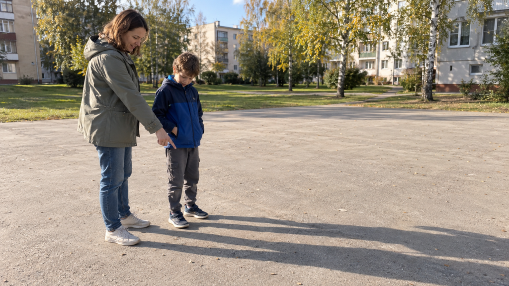
It turns out that the word for south was a time designation. And that’s a very convenient hint for a walk. Go out to the courtyard on a sunny afternoon, stand facing the sun. In Canada and the United States, except for Hawaii, you’ll see the south in front of you and the north behind you.
The noon sun can also be at twelve o'clock, and closer to two, depending on where you live and what time the clocks are set. The time for your city can be easily found in the sun calculator.
The countries of the world
In Dale, the northern part is named one of the four lands of the world. Lands, not sides.
In the past, the word «country» simply meant a side or a border. Russia, Canada, and the USA have nothing to do with it. The country of the world is a direction you can go to.
The echo remained in the conversation. «Go in all four directions,» they say to someone who is being let go anywhere. Sometimes with a sigh, sometimes with relief. If the child heard this from their grandmother, it’s time to ask what those four directions are, and to show them with their hand right in the room.
East and West
East and West
With the two remaining parties, the language seemed to be the same.
The sun rises in the morning and sets behind the houses in the evening. According to one of the versions, that is where the words "east" and "west" come from; one refers to rising, the other to setting. It is impossible to verify the etymology in the yard, but sometimes memorizing it like that helps more than any scheme.
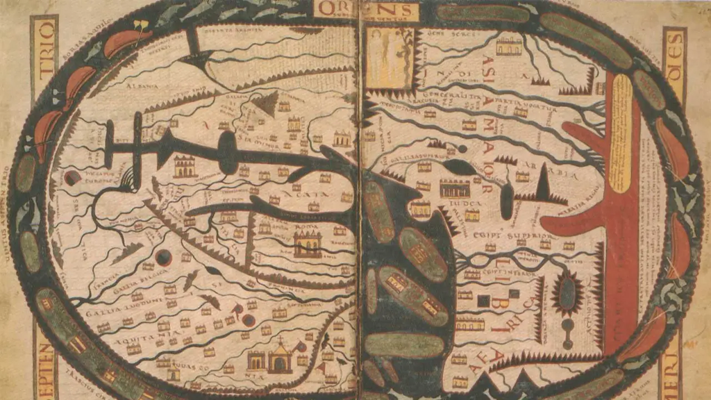
And the word «orient» actually refers to the east. Its root is the Latin oriens, meaning "east"; in other European languages it came to mean "orienting oneself" in the same way that in many medieval European maps the top was always the east, and orienting something originally meant turning towards the east.
The child who today navigates the map by north uses a word that for centuries meant east. Words sometimes take on new meanings too.
The needle that looked to the south
The first compasses appeared in China, and their main feature was the southern end. The Chinese name for the compass is still translated roughly as «the needle pointing to the south».
A good question for a child. If the arrow points one end north and the other end south, what difference does it make which one is named the main one?
Nothing. We agreed.
We also agreed that on our maps the north is drawn at the top, and on the ordinary compass the northern end of the arrow is painted. The Moroi agreed to call the southeast the eater of the midday meal. Everyone has their own words for the same sky.
And now to the yard
And now to the yard
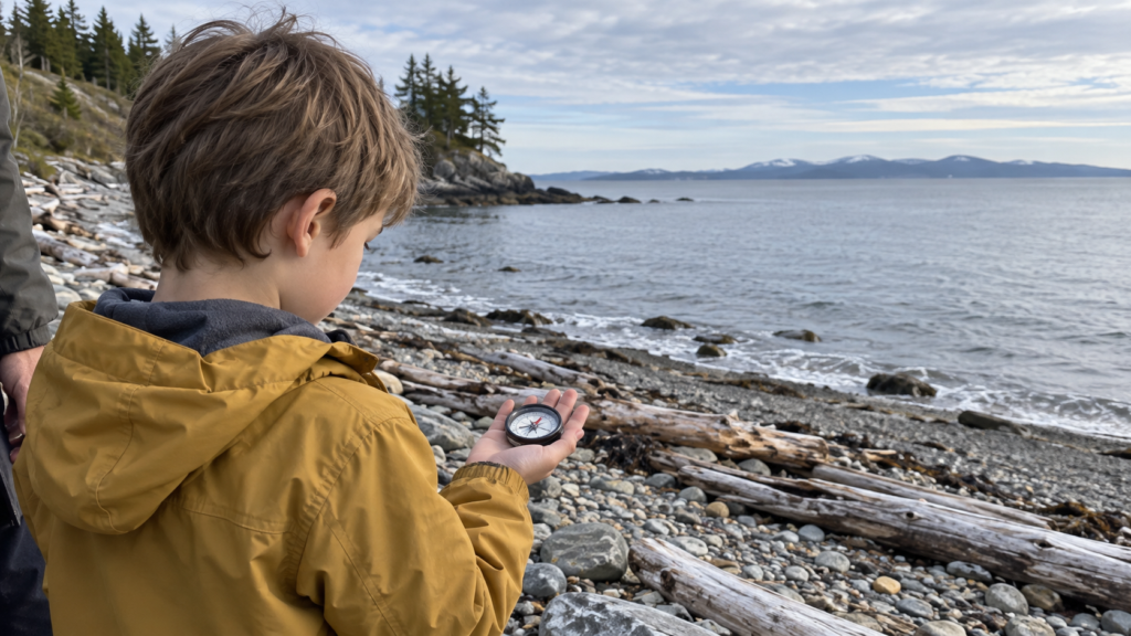
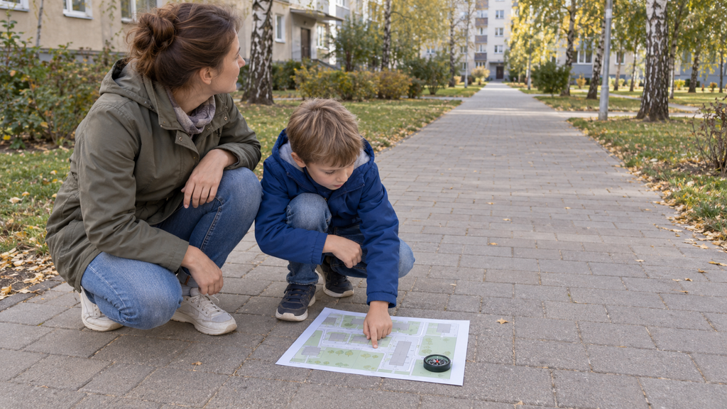
It is necessary to check all these names with your own hands. You will need a regular compass, a printout of your neighborhood, and a little patience.
The arrow will show magnetic north; it may differ slightly from the actual one. For the first walk, that is enough; why it sometimes does not match the map is explained in the walk below. We have compiled detailed steps below, from the first acquaintance with the compass to the return journey home on the map.
Walking with a compass
Six steps for an adult and a child. A compass, a printout of a familiar neighborhood, and a place where you can stop and open the map in peace are all needed.
The arrow and the letter N can point in different directions.
First, it’s worth figuring out the compass itself. It has a body with a scale and an arrow that rotates separately. The letter N indicates north, but it doesn’t find it on its own. Wherever the body is turned, that’s where it looks.
The direction indicates the northern end of the magnetic needle. It is often painted red, although it is best to check the instructions before starting the exercise. Some compasses have additional arrows and markings that are easy to mistake for the correct direction.
Hold the instrument horizontally. Step away from the car and metal fence, and remove the phone and keys. When the needle settles, look at where its northern end points. Choose a noticeable landmark on that side.
Now slowly turn the compass body with your palms, keeping it in a horizontal position. The dial markings will rotate with it, and the free arrow will again settle in its original direction after the oscillations.
Ask the child to repeat what they turned with their hand. What came back to its place on its own? Here you can see the difference between the stationary inscription on the device and the arrow that responds to a magnetic field.
If the readings keep changing, it’s too early to look for the north. Check the compass’s inclination and move away from any objects that might interfere with it.
East first to the right, then to the left
On a conventional compass, the arrow points to magnetic north. It may differ from the geographic north, so the directions in the first exercise will be approximate.
Turn your face towards where the north end of the arrow points. In front of you is the north, behind you is the south. East is to the right, west to the left. On the scale with English designations, this is N, S, E and W.
Together decide what is located on each side. You don't have to look for the object exactly along the direction of the arrow. You can say «North between the tree and the corner of the house.» This is more accurate than declaring the nearest convenient object to be north.
Now the child turns around and looks to the south. Where is the east?
If he raises his right hand again, ask him to check again with the previous reference point. East is now on the left, west on the right. The child turned around, but the sides of the light did not turn with him.
It’s also helpful for adults to stand opposite the child and point to the east. The hands will be different, but the direction is the same. Then you can switch roles, and then the child chooses which side of the light is correct, and the adult shows and explains their choice.
To answer in Russian, a short phrase is enough: «East is there.» A detailed explanation can be put together, for example: «I turned (or turned around), so the east is now to my left.» Knowing the direction and being able to describe it don't always come together at the same time.
A tree does not become a landmark forever
Let’s say that from the chosen location, the north was roughly towards the tree. Remembering this hint is convenient, especially if you pass by this place often.
But next time you'll have to start at the same point.
Go around the tree and look around. Now it is on the other side. If you continue to count it as a north marker, you will make a mistake. In fact, you need to remember the entire sequence: «From this intersection, north towards the tree.».
The same thing happens with the school, the house, and the bus stop. It is useful to ask not just «Where is the school?» but «Which side of the house is the school on?» This way the description has a starting point.
If the object is located between two main directions, it is not necessary to adjust it to one of them. On the first walk, it is quite enough to say «between the north and the east». You can add the name «north-east» when this intermediate side is already needed by the child.
The map is lying face down, and that's correct.
For a walk, you need a sufficiently detailed map that shows the selected paths, intersections, and buildings. Before printing, check the direction of north. If the app allows you to rotate the image, set the north at the top and mark it with an arrow on the printed page.
First of all, find a place on the street where you are standing. You can mark it with a small dot with a pencil. While your own position is unknown, it is easy to start showing the way from the neighboring house.
Hold the sheet horizontally and turn it north approximately along the compass. Then match the map to the terrain: find a familiar road, intersection, and another noticeable object. Position the sheet so that the directions from your point to these objects match the actual ones.
Street names can be upside down or right side up. It’s normal to have them in that order when you’re navigating. It’s inconvenient to read the signs like that, but the road on paper is directed in the same direction as the road in front of you.
The north on the map does not have to be in front of the person. It is located at the top edge of this printout, but you can hold the sheet with any edge towards you.
Why the compass does not quite agree with the map
Sometimes the buildings and the road already coincide, and the north end of the arrow points slightly away from the north of the map.
Geographical north is associated with the Earth's North Pole. The magnetic needle is aligned along the local magnetic field. The angle between the magnetic and geographical north is called the magnetic declination. It depends on the terrain and changes gradually over time.
To work accurately with the map, an adult needs to know the local declination and take into account the correction according to the instructions for the compass. On our walk, the compass helps us roughly locate the map, and then the position is refined using familiar landmarks.
Furthermore, a deviation cannot be explained by any one factor. If the arrow is pointing in a different direction from a few steps away, first eliminate the possible obstruction and repeat the measurement.
The return journey is also counted.
Select a nearby target on the map: the entrance to a park, a square, or a familiar intersection. Have the child trace the path from your point using their finger. Where is the first turn? What object will they encounter before it?
Walk along the sidewalks and paths together. Stop at the next turn and find yourself on the map again. The starting point is behind you; now the journey continues from the new location.
When you reach your destination, give the child a map for the return journey. Don't be in a hurry to remind them where to turn. Let them first find where you are standing, turn the page and follow the route home.
I would like to ask separately. If the area is east of the house, which side of the house is it from? The answer is verified using the map. When returning, the direction of travel changes, so repeating the previous commands of «right» and «left» will not be possible.
And when the north is found, you can return to the oars. Sign with chalk on the asphalt or on the leaves around you all eight winds. Sivor, polnochnik, vostok, obednik, letnik, shalochnik, west, pobereznik. And ask the child what the wind is today.
We found the north
The child goes through the card on their own after the walk. If a certain item didn't turn out, they can return to it next time.
Compass
The sides of the light
Map and route
The marks are not saved; you can take the test again on the next outing.
How the sides of the light fit into the home study geography, We discussed this separately. Why do globes and flat maps show the Earth differently? There is an article about the experience with orange peel in our article.
At Palme School, geography has its own course for children from the age of four, online and in Russian, with maps, projects, and discussions. You can start with free trial lesson.
Frequently asked questions about the sides of the world
How to memorize the sides of the world in order?
They are called according to the clockwise direction, starting from the top: north, east, south, west. In English-speaking schools, children are often given a notebook called Never Eat Soggy Waffles, where the first letters of the words match the English names of the world’s continents. You can come up with your own, Russian one with your child.
How to find the north at night?
On a clear night in the USA and Canada, the North Star helps. If you can see the bowl of the Great Bear, find the two stars on its wall opposite the handle. Draw a mental line from the bottom of the bowl to its open edge and continue it approximately five distances between these stars. There is the North Star. It hardly changes its position in the sky and indicates the direction north.
How to find the north without a compass?
In Canada and the United States outside of Hawaii, you can take advantage of the shade during the sunny midday when the sun rises highest during the day. The vertical pole shadow is then directed north. The sunny midday does not necessarily coincide with twelve o’clock. In Hawaii, this method does not work year-round.
Does the compass work on a phone without internet?
Yes, if the phone has a magnetic field sensor. For determining the magnetic direction itself, the internet is not needed. Sometimes the phone asks to calibrate the compass; for this, they slowly move the compass in the air with an eight.
Which compass is suitable for a child for their first walks?
Enough of the simple, inexpensive compass with a transparent base and a bright needle that clearly shows the north end. It’s convenient to turn the map using such a device by placing the compass directly on it.
Is it possible to find the north by looking at the moss on the trees?
It’s not foolproof. Moss grows where there is shade and humidity, and shade and humidity are present in the forest, by the water, or between houses on all sides of the trees. A good exercise is to test the compass to see if it works consistently.