

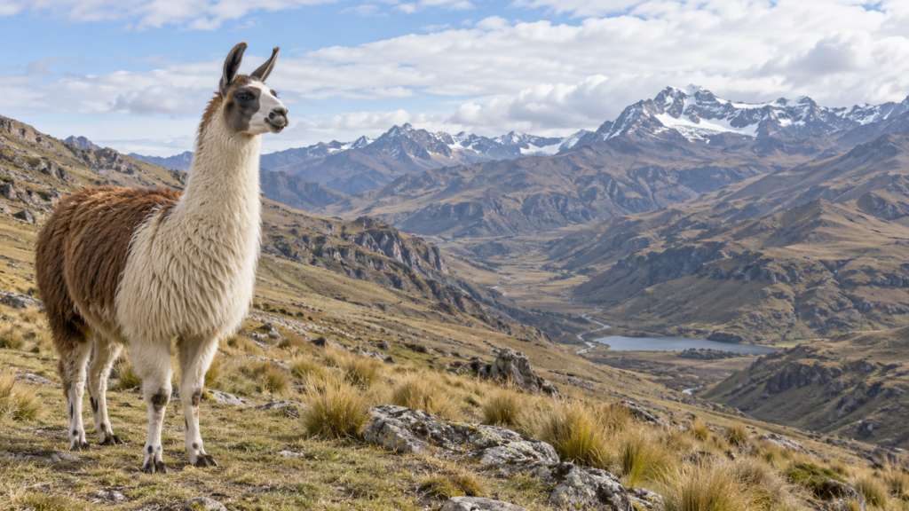

In Florida, bones of ancient relatives of llamas are being found. One of the most complete skeletons was discovered near the city of Lecontó. The animal lived here long before the advent of farms, zoos, and ships on which it could have been brought from another country.
The llama is associated with South America for us. In the photos, it stands against the Andes, next to the stone structures of Peru. Florida is on another continent. There are thousands of kilometers between them.
There is no mistake in the discovery. The camelid family, to which llamas belong, originated in North America. From there, some branches went to Asia, others to South America, while in the northern continent they eventually disappeared. This was discovered by fossilized bones, among which are Findings in Florida.
How the ancestors of South American llamas reached another continent is best explained on a map. We will look for a narrow spot between two large landmasses on it.
Passage to the south
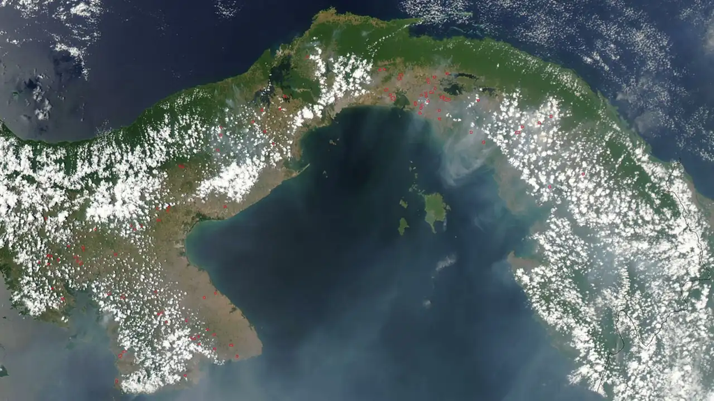
From Mexico towards Colombia stretches a long curved strip. And at its very end is the Panama Canal. Through it the ancestors of the Lampa crossed into South America.
The isthmus resembles a handle between two broad parts of land. On one side there is water, on the other also, and in the middle there remains a land passage. Today it is easy to take it for granted: it is on the map, so it has always existed.
But the continents were separated by the sea for a long time. When a land connection was established between them, terrestrial animals had the opportunity to spread out much more freely. This happened gradually, over many generations. There was no need to imagine any herd that once completely migrated from North America to South America.
The movement went in both directions. For example, giant land sloths were spreading from the south to the north. In Florida, skeletons of Eremotheria, large extinct relatives of modern sloths, have been found. Some of them could weigh up to three tons. Their South American origin and finds on the northern continent are described in the museum’s materials.
Have the child trace the ridge with a finger in both directions. Two opposing arrows through one narrow gap, and behind each one are real bone findings.
Where is the border?
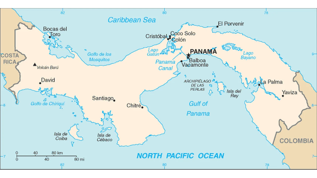
Animals migrated long before the names «Panama» and «Colombia» were coined. The modern border between the continents has no bearing on their routes.
When dividing into North and South America, as is customary, the line between them is usually drawn where Panama borders Colombia. Panama thus gets the northern mainland, while Colombia gets the southern one. Mexico, Guatemala, Nicaragua, and Costa Rica are also located in the north.
The confusion is compounded by the name «Central America». It seems as if a third continent has appeared between the two continents. In reality, this is how the region is called in the southern part of North America.
There is also the Panama Canal on the isthmus. On a detailed map, it can be found inside Panama, on the side of the Colombian border. It allows ships to pass between the Atlantic and Pacific Oceans. In our comparison, we do not include it for the continents.
From the isthmus to the Andamans
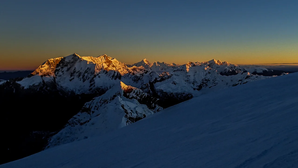
South of Panama, the land is expanding. Along the western side of South America are the Andes. It is these mountains that are visible in many photographs with llamas.
On the physical map, near the western coast, there is a strip of highlands. Through Peru and Chile, it can be traced far to the south. If we look at the northern continent, a similar arrangement is revealed: its western part is occupied by the Cordilleras, a large system of mountain ridges.
To the east of the Andes flows the Amazon with all its tributaries. On the map it looks like a tree with branches: the tributaries from all sides carry the water into one big river, and the latter leads it to the Atlantic Ocean. North and south of this area rise the highlands, for example the Brazilian Plateau. So there is no flat plain right behind the mountains. This can be verified using the physical map of South America.
For comparison, let’s take the Mississippi River on the northern continent. Its path mostly leads south, to the Gulf of Mexico, and the Gulf is connected to the Atlantic Ocean. The Amazon River, however, follows a course mostly to the east. It won’t be possible to remember both rivers with the same arrows from top to bottom.
Further south, but not necessarily warmer
On the way from North America to South America, you first approach the equator. Then you cross it and start moving away in the opposite direction.
Therefore, the word «south» by itself does not mean «warmer». It is still cold in the far south of South America. In the high Andes, cold can also be encountered much closer to the equator, because temperature also depends on altitude.
The equator crosses Ecuador, Colombia, and Brazil. Part of South America lies in the Northern Hemisphere. North America does not have this feature: it is entirely located north of the equator.
Find two cities together: Chicago and Buenos Aires. In December, it is winter in Chicago, and summer in Buenos Aires. Due to the tilt of the Earth’s axis, the seasons in the hemispheres are opposite. At the same time, cities near the equator live with a different seasonal rhythm: the usual snowy winter and warm summer may not even be noticeable there.
Two arrows on one map
Let the child draw only two markings on the map: «ancestral llamas» with a arrow pointing south and «giant lazy ones» with an arrow pointing north. They indicate the direction of the herd, not the exact path.
Next to it, add the Andes, the Amazon, and the Mississippi and draw the equator. The rest for comparison is shown in the table.
Two continents close to each other
It is easier to compare using two maps of the same scale or a globe. The rows in the table are the tasks: find each pair on the map.
| What are we comparing | North America | South America |
|---|---|---|
| Where is it lying? | From the Arctic regions in the north to the Panama Canal in the south | South of the Panama Canal, at the southern tip of the Fire Islands archipelago |
| Equator | Entirely north of the equator | The equator crosses the continent, passing through Ecuador, Colombia, and Brazil. |
| Oceans on the sides | The Pacific Ocean from the west, the Atlantic Ocean from the east, the Arctic Ocean from the north | The Pacific Ocean from the west, the Atlantic Ocean from the east |
| Mountains on the western edge | Ropes | The Andes, the longest mountain range on land |
| River for comparison | Mississippi, flowing south into the Gulf of Mexico in the Atlantic Ocean | The Amazon River flows east into the Atlantic Ocean |
| The largest country by area | Canada | Brazil |
| What languages are spoken | Mostly English and Spanish, in Canada also French | Mainly Spanish, in Brazil Portuguese |
The boundary between the continents is conventional. It is usually drawn around the Panama Canal, often along the border between Panama and Colombia, so Mexico and Central America belong to North America.
[PLACE TWO CARDS OF THE SAME VALUE TOGETHER]
On the modern map, North and South America are connected by a narrow strip. Fossil evidence shows how much it has changed since its formation. Animals that were once separated by the sea have found new territories. And for paleontologists in Florida, there are now bones of llama relatives that we used to associate with the Andes.
Why different continents are perceived differently by mothers in different schools, explained in an article about, How many continents are there on Earth. Other card-based activities are collected in guide to home geography.
At the Palme School, children from the age of four can study geography online in Russian. You can meet the teacher and learn more about the course format at free trial lesson.
Frequently asked questions about North and South America
How many countries are there in North and South America?
In North America, including Central America and the Caribbean region, there are 23 independent states; in South America, there are 12. Dependent territories are not included in these figures; different sources give slightly different counts.
Where does Mexico belong, in North or South America?
North America includes Mexico and the countries of Central America, including Panama. The conventional boundary with South America is often drawn along the border between Panama and Colombia.
Why do some countries consider America to be one continent, while others consider it to be two?
In some countries, especially in Latin America, North and South America are considered one continent. In the Russian and American schools they are usually divided into separate parts. More details about this can be found in our article about Number of continents.
What is Latin America?
Latin America is a historical and cultural region. It usually includes Mexico, most of Central and South America, and part of the Caribbean region. Spanish and Portuguese languages are widely spoken here; some definitions also include French-speaking countries and territories.
Which continent is larger?
North America is larger in area. South America is smaller, but it has the longest mountain range on land, the Andes, and the world's most voluminous river, the Amazon.
Why is it summer in Argentina when it’s winter in Canada?
Argentina is located in the Southern Hemisphere, while Canada is in the Northern Hemisphere. Due to the tilt of the Earth's axis, the summer in one hemisphere coincides with the winter in the other. Therefore, New Year's Eve in Buenos Aires is celebrated in the summer.