
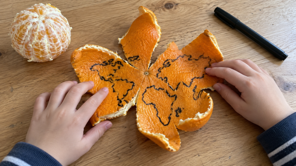

An orange and a marker are needed.
Draw something similar to a continent on the peel. It doesn't matter if it's crooked. Place Africa in the middle, something on top, something on the bottom. Then carefully peel off the peel and try to place it on the table so that the drawing lies flat, just like on a sheet of paper.
It won't work. The bark either tears or crumbles, or you have to stretch it with your fingers. Africa is moving away, the upper continent is spreading out.
That is the main question about the cards, only in the kitchen.
Round doesn't fit flatly
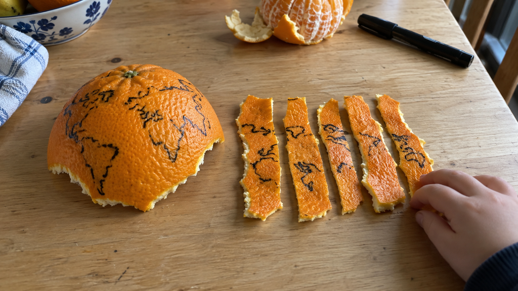
The Earth is round. A sheet of paper is flat. You cannot transfer one onto another without loss, no matter how hard you try, and mathematicians have long proven this.
Cutting a sphere is not easy; even a piece of orange peel cannot be stretched flat without distorting its shape. Therefore, on a world map, we have to separate neighbors and change proportions as well. Any flat map distorts something—the size, distances, or shapes. On many maps, Antarctica stretches out as a long strip along the entire lower edge. In reality, this is a cap around the South Pole; there is no such strip at all.
The globe doesn’t know about this problem. It is round itself.
Here is the answer to the question from the title, in a nutshell. The globe is a reduced spherical model of the Earth. The continents, water, and countries lie on it just as on the planet, without any cuts or gaps.
Take the largest piece of crust and divide it into several narrow strips. Try to arrange them next to each other while keeping the pattern intact. Which one is easier to press against the table, the wide piece or the separate strip? Also look at the gaps between them. If you move the edges closer together, will the entire crust remain flat?
The globe is assembled from the same plates
The funniest part starts when you find out how globes are made.
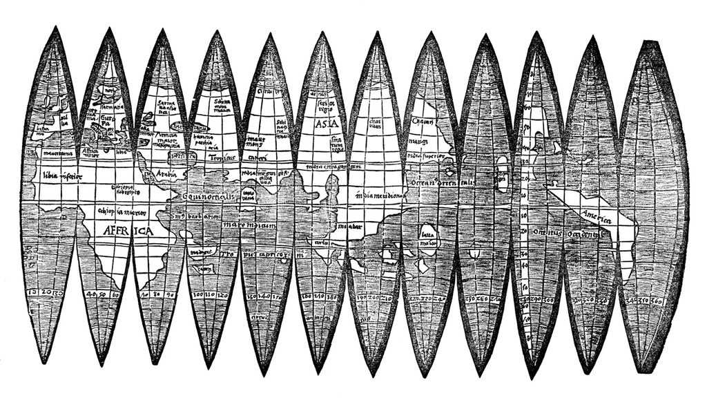
The classic way is like this. The map for the globe is printed on a flat sheet of paper. But not in a rectangle, but in narrow petals that converge towards the poles. When arranged side by side, they resemble peeled orange peel, if you cut it neatly into slices. These petals are glued onto the ball one by one. To replicate its shape, the paper is moistened, carefully stretched and smoothed, joining the edges of the drawing.
That is, the globe travels in the opposite direction of the orange. We removed the peel from the sphere and couldn’t put it back together again. We take the petals off flat and fold them back into the sphere.
That's what they did a hundred years ago and five hundred years ago too.
What picture is more honest?
The globe. In size, distance, and who lives next to whom. Chukotka and Alaska are shown on many maps as separated from one another at different points on the map, but on the globe it is clear that they are neighbors. Their land masses are separated by the Bering Strait, which in its narrowest part is less than ninety kilometers wide.
But you still need a map. You can fold it up and tuck it into your backpack. On it, you can see the whole world at once, but with a globe you can only see half of it; the other half has to be turned towards you.
So it is more useful to keep a map and a globe at home and compare them.
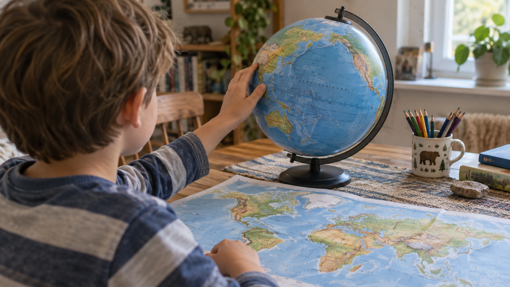
Five tasks with an orange and a globe
The tasks can be done one at a time. There are three levels of answers for each one. Choose the one that the child can do in Russian right now. The phrases below are examples. Check them on the globe and change them according to the location of your cities and countries.
Disassemble the orange
Draw several continents on the peel of an orange; peel the orange and ask the child to arrange the continents on the table so that the drawing lies flat.
Show me. The place where the skin has torn or stretched.
Name it. «It doesn’t fall down exactly straight.
Explain. «The bark was in a ball shape. To flatten it on a table, you have to change its shape. On a flat map, the outlines and sizes can also change.
Find your country and the country of your relatives
Ask them to find the country where the family lives, and then the country where their relatives live. The child should turn the globe themselves. If their city is not shown on the globe, show them an approximate location near the city or river that is signed.
Show me. The child points a finger at both countries.
Name it. «We live here, and our relatives live there.
Explain. «Russia was not visible until we turned the globe.».
Where is the north
Ask them to show you the North and South Poles, then compare the place where the child lives with the place where their relatives live. Which of them is further north?
Show me. The child points to two points on the surface of the globe through which the axis passes.
Name it. «This is the North Pole, this is the South Pole.».
Explain. «This city is located further north because it is closer to the North Pole.
Find the equator
Ask them to trace the equator with their finger and answer which hemisphere the family lives in and which is their native region.
Show me. The finger goes along the line around the sphere.
Name it. «We are in the northern hemisphere.
Explain. «To get to Australia, you have to cross the equator, and there’s no one there to take you home.
Compare the globe and the map
Place a map of the world next to it, with Alaska on the left side and Chukotka on the right. Have them first find it on the map and then on the globe.
Show me. Two coasts on the map and two coasts on the globe.
Name it. «They are near each other on the globe.».
Explain. «On the map they are at different ends because it was cut in the Pacific Ocean, and the ends continue one after another.
If the child is silent, do not give the whole answer. It is enough to start the sentence with something like «The parents live…,» or «Between us…».
The experience with the orange takes ten minutes, and then it is remembered every time a child is surprised by why Greenland is so big on the map. How such experiences fit into home life study geography, We discussed it separately.
At Palme School, geography has its own course. It's for children aged four and up, online and entirely in Russian, with maps, projects, and discussions. You can start with free trial lesson.
Frequently asked questions about globes for children
Which globe to choose for the first lessons?
To start with, a globe with large labels would be suitable, on which land and water are clearly distinguishable. The political one shows the countries in different colors, while the physical one shows mountains, plains, and depths. The political one is more convenient for finding your home and your relatives.
What are parallels and meridians?
These are imaginary lines that are drawn on globes and maps. The parallels run from west to east around the Earth and do not intersect. The equator is also a parallel, the longest of all. The meridians connect the North and South Poles. Together these lines form a grid that defines the positions of places on the Earth.
Why is the axis of the globe tilted?
Thus, the globe repeats the real Earth, whose axis is also tilted. Due to this tilt, the seasons change on the planet, and it will be convenient to talk about this later when the child gets used to the poles and the equator.
Is it possible to practice without a real globe?
You could start with a ball on which to draw together the sun and water, or with an interactive model of the Earth on the screen. The main thing is that the ball can be rotated and you can find places on it, rather than just looking at the finished picture.
How can you talk about the globe if it’s difficult for a child to explain it in Russian?
Start with simple sentences and short phrases like «here,» «there,» «in the north,» «nearby.» Longer explanations with words like «between,» «to the south,» and «on the other side» will come later, when the child gets used to the activity itself.
When was the word "America" first written on a globe?
In 1507. The cartographer Martin Valdezemueller printed the petals for a small globe and named the new land beyond the ocean America, after the navigator Amerigo Vespucci. He later refused to use this name himself, but other cartographers adopted it and it became established. Only five copies of the 1507 petal are known.