

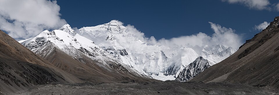

There is something on Mount Everest that would be more logical to be looking for somewhere else.
Sea bottom.
It’s not water, of course, nor is it sand with seashells. It’s a real stone. The light limestone once formed at a height of almost nine kilometers in a warm shallow sea. It contains remnants of creatures that lived in the sea long before the Himalayas appeared.
The age of these breeds is about 450 million years. The Himalayas themselves were formed much later in the Earth's history.
It turns out to be a strange problem: the sea was below. The stone is now up there. What happened between these two events?
At first there was no mountain at all.
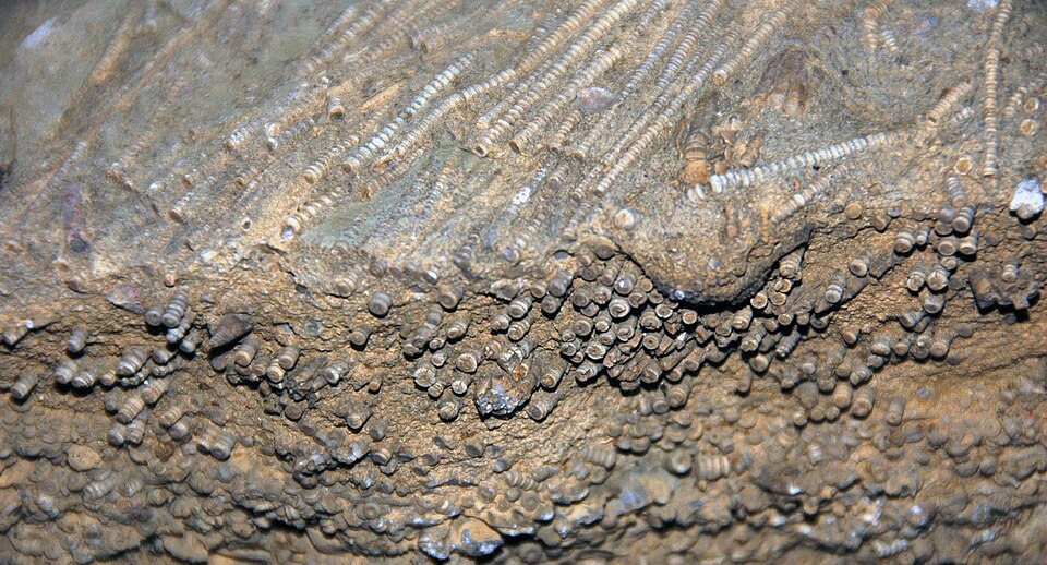
If we mentally remove Mount Everest, what will remain is not a pit in its place, but a completely different ancient world.
Hundreds of millions of years ago, where the Himalayas appeared much later, there was a sea. Deposits accumulated at its bottom. Marine organisms lived in the water; some of them left behind solid parts of their bodies, which ended up in the future species.
This is how limestone was formed.
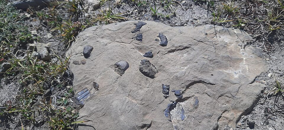
Today, geologists find fossil remains of brachiopods, crinoids, and other marine animals in the upper rocks of Mount Everest. The International Union of Geological Sciences calls the highest rocks on Earth fossil marine limestone of the Ordovician age.
It's good for a child to stay here for a while.
The stone did not «remember the sea» in the figurative sense. In it, indeed, traces of organisms that lived in the water remained.
But the mountain did not immediately rise from the sea. Hundreds of millions of years passed between the two events.
India was not where it is now
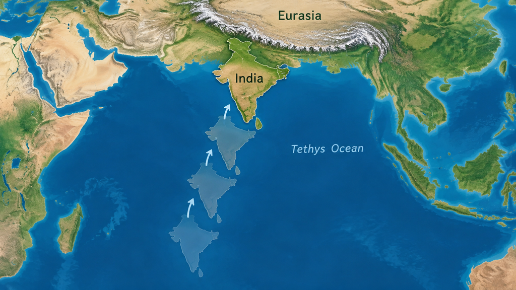
Look at the modern map of Asia.
India faces the vast Himalayan mountain range from the south. Beyond lies the Tibetan Plateau.
If you look at the current map alone, it seems that this has always been the case.
There wasn't.
The Earth's crust is broken up into large moving plates. The Indian plate has been moving north for a long time. Between it and Eurasia lay an ocean that geologists call the Tethys Sea.
The ocean between India and Eurasia gradually became smaller. Its oceanic crust was sinking deeper, while India itself continued to move northward.
At some point, there was almost no free space between the two continents. About 60 million years ago they collided. Geologists cannot pinpoint an exact year: different rocks and structures give slightly different dates. For the central part of the future Himalayas, modern research more often indicates a time span between 65 and 59 million years ago.
That was when the history of marine limestone took a completely different turn.
The two continents did not fit together like two books.
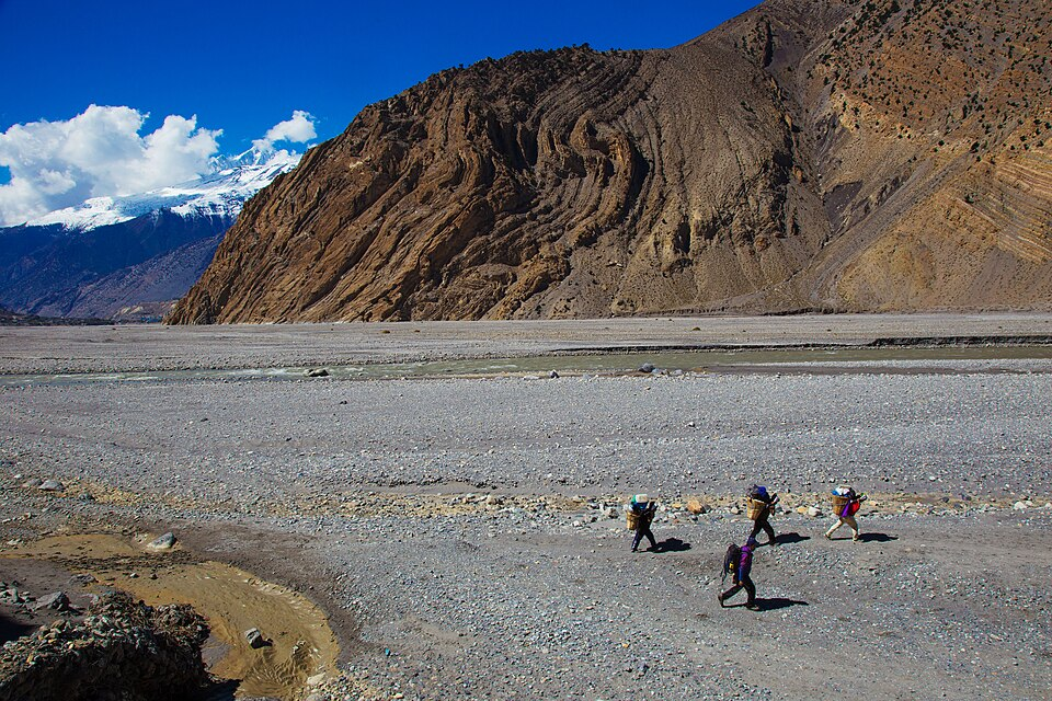
There's a tempting picture with the mountains.
Put two towels on the table, push them together, get a crease in the middle and say: «That’s how the Himalayas came about.».
For a first encounter, this fold helps to see one thing: if huge sections of the Earth's crust continue to come together, the rocks have to deform.
But the real Himalayas are more complex than a towel.
The plates crumpled, broke, and shifted along the fault lines; some of them piled up on top of others. The Earth's crust thickened in the collision zone. Part of the Indian Plate went under Eurasia. Various parts of the future mountains and the Tibetan Plateau were uplifted; this happened not simultaneously and not at the same rate. Geologists are still clarifying the sequence of these events.
For our sea breed, the main thing is easier.
It ended up within a huge area that the collision of the plates was raising and rearranging.
What had once been underwater was now very much above it after a very long time.
Why the rock on top does not mean that the sea reached the top
It’s worth talking about this separately, because error is almost inevitable.
If a marine fossil is found in the mountains, a child can easily imagine a vast ancient sea with a height of eight kilometers.
Such a sea was not needed.
When limestone was being formed, there was no Mount Everest in that area yet. The rock was located much lower. It only gained its height later.
Therefore, the correct question is not:
«How did the sea rise on Mount Everest?»
A:
«How did a stone from the bottom of an ancient sea end up on top?»
The difference is only small in the ear.
In the first case, the sea moves.
In the second, the Earth's crust itself changes.
The mountain is growing and at the same time being destroyed
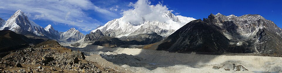
If the plates continue to move closer together, it seems that the Himalayas must keep getting higher and higher.
But the mountains have opponents.
Water flows down the slopes and carries away rock particles. Glaciers move and break up the rock. Temperature fluctuations help create cracks. Rivers carry material from the mountain valleys.
The mountain is involved in two stories at the same time.
Tectonic processes raise and deform rocks.
The erosion removes material from above.
Modern studies of the Himalayas show that the area continues to experience rapid geological-scale reduction and thickening of the Earth's crust. It is the movement of the plates that is also associated with the region's severe earthquakes.
Therefore, the question «are the Himalayas growing now?» is inconvenient to answer with a single word.
The Earth's crust continues to deform and rise in different places, while the surface of the mountains simultaneously disintegrates. The height of a particular peak is obtained from several processes simultaneously.
Why Mount Everest is easier to study from below

To understand mountains, a child does not need to start with a record of height at all.
It's better to look at an ordinary stone.
If there are layers in it, ask why they are arranged in that way.
If the mountains in the photo are standing almost vertically, although the sediments once deposited more horizontally, ask what happened to them.
If a marine fossil was found deep in the mountains, remember Mount Everest.
Geologists study mountains by looking for these traces. The rock tells us what conditions it formed in. Its position shows what happened next. Fossils help us understand the age and environment in which the sediment accumulated.
On the map, the mountain looks like a brown spot or a sign of the peak.
There is a biography in the stone.
The highest point holds very old sediment
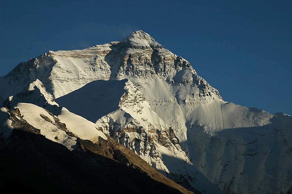
Everest is famous for its height of 8,848.86 meters. It answers the question about the current height of the summit above sea level.
But the stones at the top tell a story that began much earlier than the very creation of the summit itself.
About 450 million years ago, sediment accumulated in a warm shallow sea. Marine animals lived there. The sediment turned into a sediment lump.
Over hundreds of millions of years, the movement of the plates created a completely different map of the world. India moved closer to Eurasia. The continents collided. The Earth's crust began to shrink, thicken, and rise.
And today, an alpinist almost on the roof of the world can stand on limestone that formed where there was once sea water.
This is perhaps the most important thing to remember about mountains, apart from all the terms about ridges, slopes and peaks.
The mountain shows not only that it is high right now.
Sometimes it retains what was very long ago at the bottom.
Three tasks with mountains and rocks
There is no need to look for real sea-sanded limestone. For these tasks, a map of Asia, two towels, and a brief history of Mount Everest from the article will suffice.
Compile the stone's biography
Name five events in a confused order to the child: sediment at the bottom of the sea, the formation of limestone, India moving north, the collision of continents, the uplift of rocks high above sea level.
Ask them to arrange them from the earliest to the latest.
How to check
At first, marine sediments accumulated at the bottom; then they turned into sediment. Much later, India approached Eurasia; a collision of plates began, and the sediments were involved in the uplift and deformation of the future Himalayas.
Make a fold from towels
Place two towels on the table with the edges touching each other and slowly move them apart. Watch as the fabric folds into folds and becomes thicker.
Ask the child what this experience shows and what it cannot show.
How to check
Towels illustrate one idea well: when compressed, the material deforms and folds into folds. But real Himalayas are much more complex: the rocks break, shift along fractures, and overlap one another.
What came up—the sea or a rock?
Imagine two pictures. In the first one, a marine animal lives in a shallow sea. In the second one, its fossil remains are located high in the Himalayas.
Ask: what should have changed between these two pictures?
How to check
There is no need to imagine a sea several kilometers high. The limestone was formed when Mount Everest did not yet exist. The rock was formed much higher above sea level later, along with the uplift and remodeling of the Earth's crust.
The main question for all three tasks: What happened to this stone before and what happened afterwards? This is how the child begins to read the mountain as a story, rather than as a finished shape on a map.
Geography begins with the question of why.
At the Palme School, children work with maps, compare natural objects, and learn why the Earth looks the way it does. Mountains, oceans, continents, and natural zones become not lists of names but stories that can be reconstructed using maps and observations.
Try a geography lessonFrequently asked questions about mountains for children
Is it true that there are marine fossils at the summit of Mount Everest?
Yes. The upper layers of Mount Everest contain marine limestone of the Ordovician age and fossil remains of organisms that lived in the ancient sea about 450 million years ago.
Does this mean that the sea once reached the top of Mount Everest?
No. When limestone formed on the seabed, Mount Everest did not yet exist. This rock formation appeared much later, above sea level, when the movement of the lithospheric plates formed and uplifted the Himalayas.
How old are the rocks on Mount Everest?
The highest limestone rocks on Mount Everest are about 450 million years old. They are much older than the Himalayas themselves.
When did the Himalayas begin to form?
This did not happen at one point in time. Modern studies place the beginning of the collision of the continental parts of India and Eurasia in the central part of the future Himalayas at approximately 65–59 million years ago. The exact date continues to be debated.
Are the Himalayas growing now?
The Earth’s crust in this region continues to deform due to the movement of the Indian Plate. At the same time, water, glaciers, and other processes are destroying the surface of the mountains. Therefore, the elevation change of a particular peak depends on several processes at once.
What is the official height of Mount Everest?
The current official height of Mount Everest is 8,848.86 meters above sea level. This was jointly declared by Nepal and China in 2020.
Are there marine fossils in the mountains of Canada?
Yes. The Burgess Shale is located in Yoho National Park in British Columbia. The fossils of animals that lived in the sea about 508 million years ago have been preserved in these layers, which are now located in the Rocky Mountains at an elevation of more than two thousand meters. Only Parks Canada guides are allowed to visit the sites.